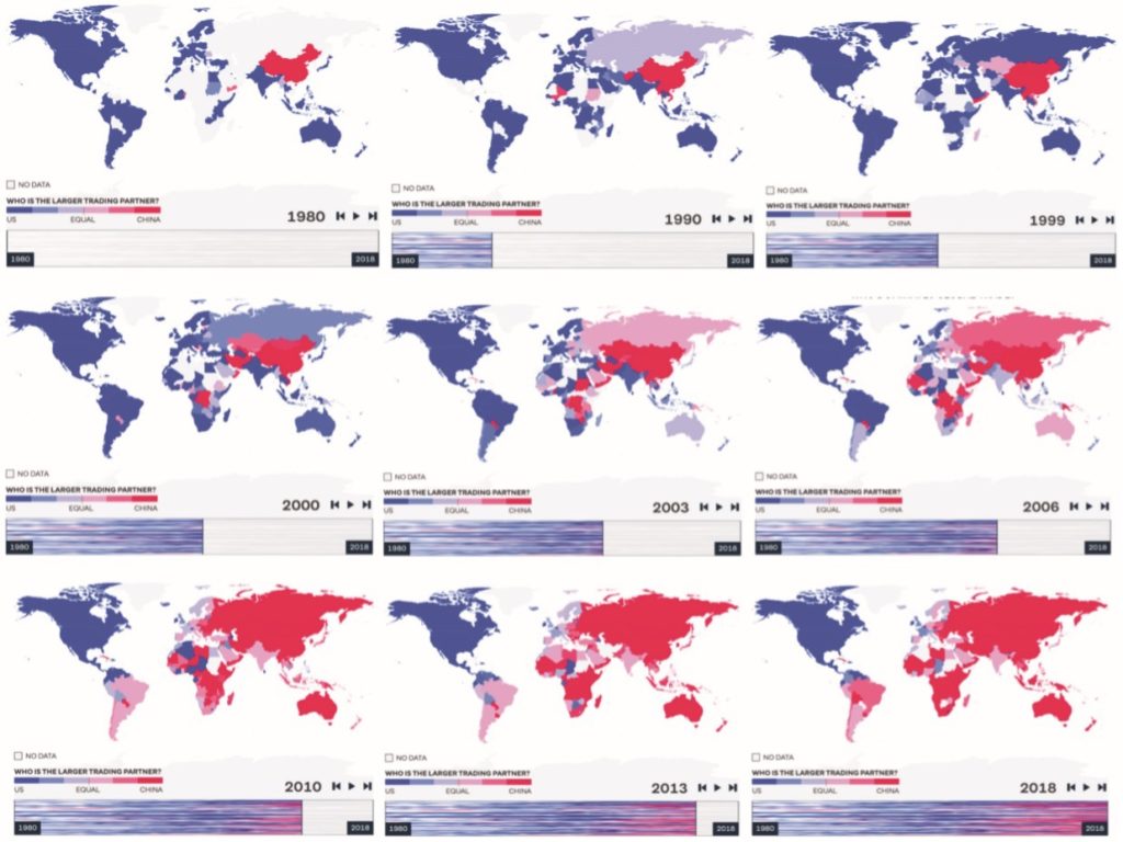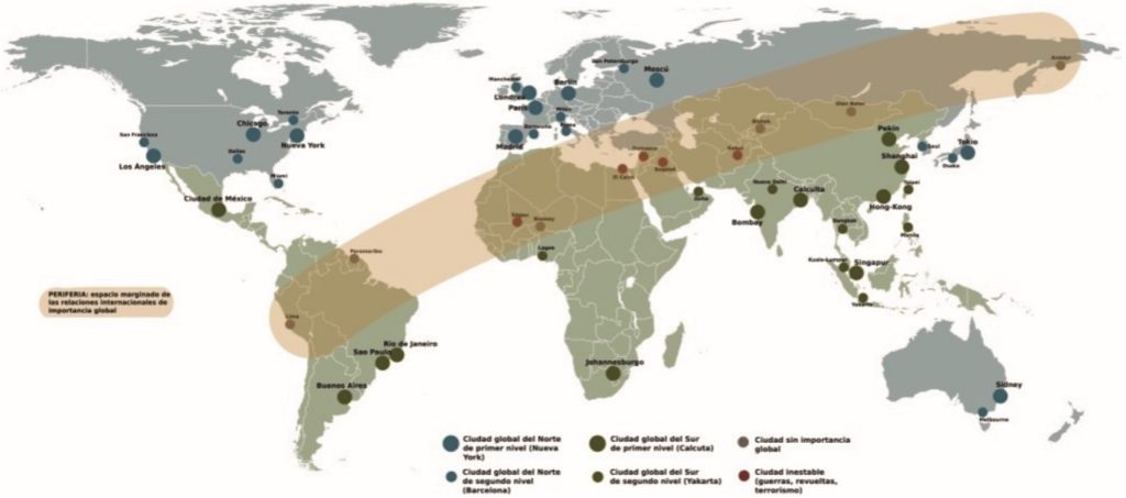
The geofusion map of the 21st century
As discussed in previous chapters, the fusion of places or geofusion is a geographical synthesis producing new results in geography with the simultaneous application of economic policy, technology, design, and visualization. Geofusion maps offer new perspectives on a wide range of areas, explaining geopolitical and geoeconomic correlations. Geofusion mapping methods employ connectivity factors and infrastructural and knowledge networks, to determine global hubs and a new way to interpret the geopolitical structure in geographical hubs.

